Review internal geometry
Discuss tanks, enclosed structures and other difficult internal areas with your site team. Access size, obstructions and the recovery plan determine what can be attempted.
 Discuss a project
 Confined-space drone inspection in Kuwait with Orbit’s Flyability Elios 3. Discuss internal asset visibility, access, coverage and useful inspection records.
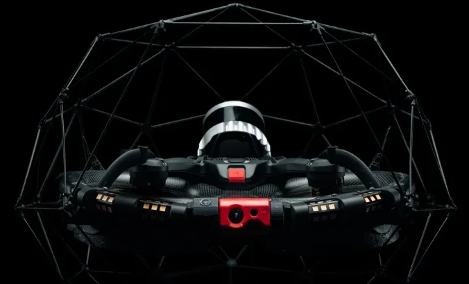
Flyability Elios 3 · interactive wireframe
Orbit owns and operates the Flyability Elios 3 for suitable confined and GPS-denied inspection environments. For asset owners in Kuwait, the first step is a feasibility discussion: the access opening, internal geometry, atmosphere, visibility and what must be recorded. A protective cage helps the aircraft work close to structures; it does not make every internal environment safe for flight.
Discuss this serviceDiscuss tanks, enclosed structures and other difficult internal areas with your site team. Access size, obstructions and the recovery plan determine what can be attempted.
Agree a coverage plan and a naming or location-reference system so the asset reviewer can understand where each observation belongs.
Define visual documentation first. Surveying or ultrasonic-thickness applications require the appropriate confirmed package, procedure and acceptance criteria.
Coverage, formats and intended use are agreed before capture.
What an internal drone inspection can show, what to include in the report, and how to brief the asset, access and operating conditions before a visit.
Start with the asset, environment and decision you need to make.
Agree coverage, timing, access, equipment and useful deliverables.
Collect the agreed imagery or data with site coordination.
Receive organised outputs prepared for the intended workflow.
Yes. Orbit owns and operates Flyability Elios 3. Share the asset and inspection objective so we can discuss a suitable capture scope and equipment configuration.
No. The asset operator must confirm appropriate site conditions and access arrangements. Atmosphere, contamination, temperature, dust, liquids, internal obstacles and signal conditions all affect feasibility. The cage is not a substitute for a site-specific assessment.
They are not assumed in every inspection. Tell us whether you need spatial surveying, visual evidence or thickness readings. The fitted package, processing, operator workflow and reporting requirements must be confirmed for that scope.
Drone imagery may help an asset team review some areas remotely, but it does not remove every need for physical access, specialist testing or maintenance. The site team determines what further work is required.
Share the location, timing and intended use in a project enquiry. We will discuss coverage and delivery with you before a capture plan is agreed.
Prepare a project enquiry